 Alta Via dei Lattari1876 — 20262026 Edition
Saturday 10 October 2026
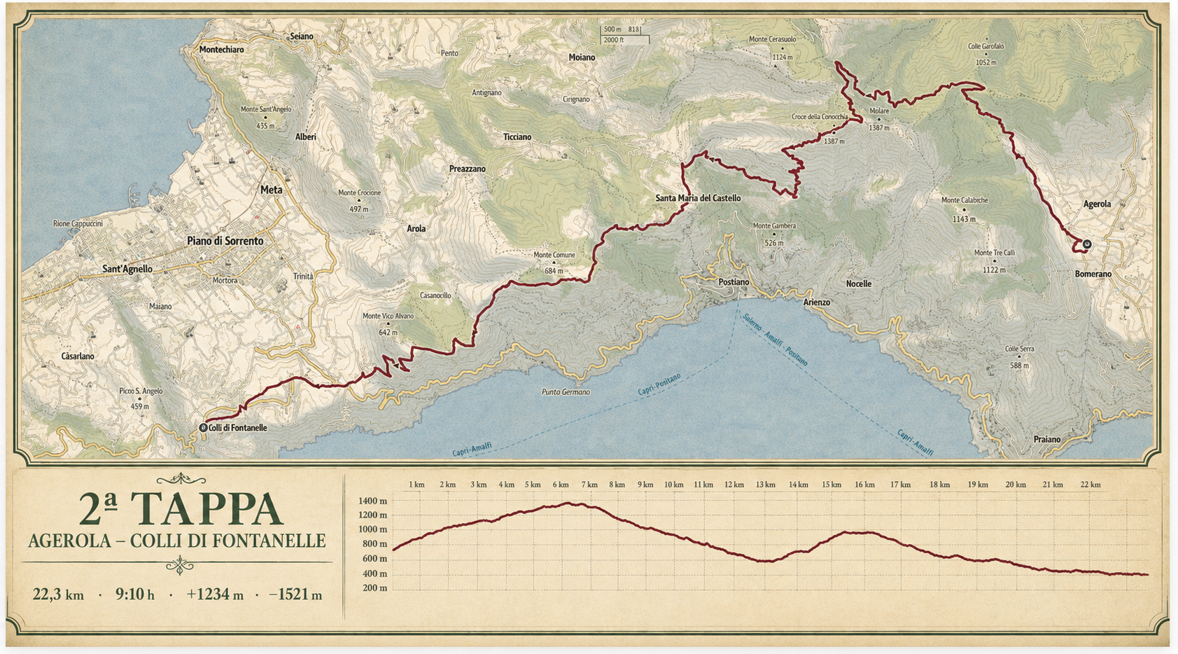
Agerola — Colli di Fontanelle
The high-altitude day, across Conocchia and Monte Comune, with wide-open views over both gulfs.
Places along the way
A stage to be read.

This is the central and most mountainous stage. The elevation, distance and continuity demand a steady pace and solid preparation.
Agerola · Faito · Croce della Conocchia · Monte Comune · Colli di Fontanelle
Technical data and operational points will be checked in the field and shared in the Participant Guide.
Open on Outdooractive ↗The route
The high-altitude stage between two gulfs.
Stage two connects Agerola with Colli di Fontanelle over 25 kilometres, with 1,150 metres of elevation gain and the highest point of the crossing at 1,390 metres.
Croce della Conocchia and Monte Comune open views over the Gulfs of Naples and Salerno. This is where the mountain character of the Alta Via becomes most continuous.
What makes this stage distinctive
- The Agerola plateau
- Croce della Conocchia
- The Monte Comune ridge
- Views over the Gulfs of Naples and Salerno
How to prepare
Altitude, distance and exposure to the elements demand solid preparation. Maintain a steady pace and carry only what is essential, without omitting layers for sudden changes in weather.
Frequently asked questions
Before setting out.
How demanding is this stage?
This is a demanding hiking stage within a three-day crossing. Distance, elevation and continuity require training and experience of long days on foot.
Where can I find the GPS track?
The track is available on Outdooractive through the button and QR code on this page. Operational details will be checked again in the field before the 2026 edition.
How do I arrange accommodation and transfers?
Recommended accommodation, connections and practical information are collected in the Plan your walk section.